

PNT 6/27-7/6, 2019
Chief Mountain to FR 114
Note: Journal by me, M (age 68 at the time of our hike). R is my husband (age 65 then). J is our daughter who lives in Spokane.
6/26/19 Wednesday
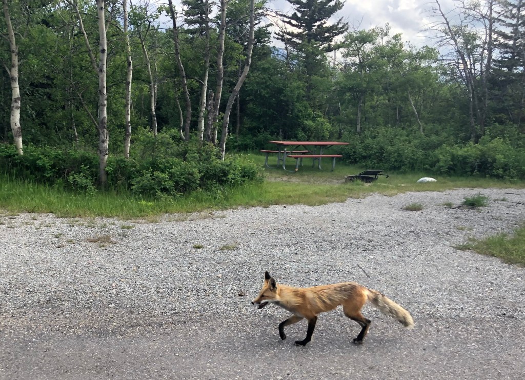
~5:00 p.m. Nothing much to read. Time to write. Summer is for walking away passivity. We are at St. Mary’s Campground. Have permit. Snow on high passes reported to be melted. Just passed a large fox—red, with long golden tail—cruising along the campground loop road. On an empty closed loop. I was walking back from the Visitor Center where I went to see about transport to Chief Mountain. Only option is a taxi out of East Glacier for $80 per person! We decided to try hitching a ride in the morning instead. Packs will be heavy, with extra fuel (not sold in Polebridge), microspikes, and bear spray. I dozed some in the shuttle to here. Really want a nap. It was sooo hard to sleep on the train. I kept sliding down the large seat, and the aisle lights were right in my eyes. We had a nice breakfast on the train about 6:00 a.m.
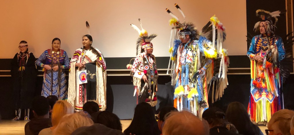
~8:45 p.m. We went to the Indian (Blackfoot) songs and dances at the Visitor Center. Very fun! Regalia (proper word they said) a blend of traditional and modern. Some looked like maybe inspired by sage grouse and other lek-type birds. Sure enough later in the program there was one called “Chicken Dance” that was exactly that. By a 6th grader no less! It’s still light even with clouds. Ready for tomorrow. Need that ride!
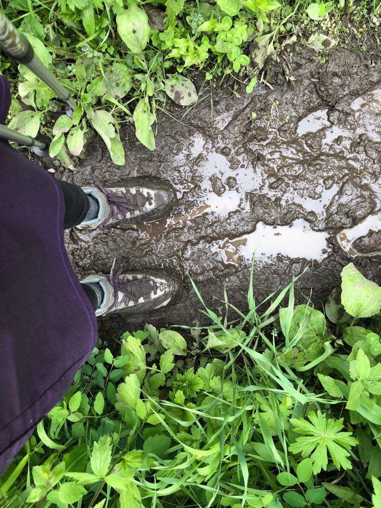
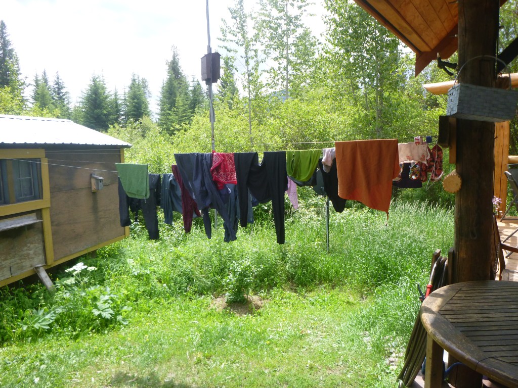
6/27/19 Thursday. R said —> Mellow! Muddy though. Rain overnight. Rain this morning. We slept 9:00 p.m. to 8:00 a.m. so we were much better rested. Over breakfast another camper, a retired-looking guy, stopped over and asked how we came to be there with no vehicle. We explained. He wanted to visit some about all his RV vacations, which sounded great. His wife RVs but doesn’t camp. He used to backpack, interested in our plans. We packed up in the wet and walked to the Visitor Center where I got a road map. They were having their annual Going to the Sun Road opening celebration in the auditorium and the permit ranger invited us to go have a cookie and coffee but when we checked it out the ranger at the door said no it was just for folks coming to the event and since we were heading out for the trail that wasn’t us. No problem. After a last rummage of R’s pack we walked the 1/2 mile or so to the road junction. R bought gloves (he forgot his all-weather ones at home) and we went across the highway to hitch north. Fortunately the rain stopped but we kept our rainsuits on for warmth.
Lots of folks coming and going, lodge and cabins and campground and gas stations, etc. All on the Blackfeet reservation on that side. After about 20 minutes a couple about our age turned around and came back for us. The woman (C) asked if we were hiking into the park & we said yes, at Chief Mtn/Belly River, and she said “Y’all got our permit!” Turns out she didn’t really mean that, but that their permit reservation had been messed up by their first couple of nights being closed for snow (Helena Pass) and their alternate out of Belly River was all full of other hikers like us already. They were super friendly. She said they like to backpack as a “beach vacation”—short hikes in, lots of wildlife watching and reading and day hiking from backcountry campsites. Sounded fun. When we got to their destination at Babb, they decided to drop off the husband at their lodging and C would take us all the way to CM. We thanked her enthusiastically and told her that made her a “trail angel” for sure. They are from Indiana, have acreage there. She said she is a political “moderate” which seemed to mean Republican (from Indiana after all) but appalled by Trump and the current state of corruption and all those poor migrant kids. We talked about there being a lot more common ground when people think about actual issues rather than dogma. She took our picture at the trailhead and we rummaged a bit more & then we were all ready to go.

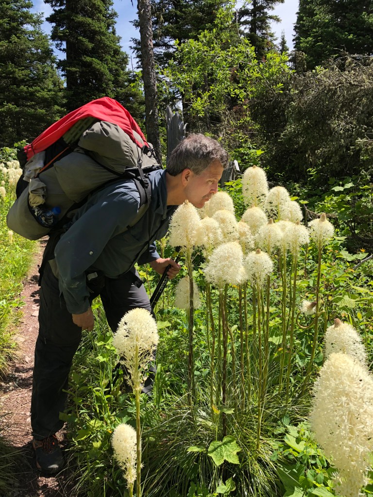
Off on the trail at about 11:30. Rain gone but still overcast, low clouds on the mountains. Warmed up with hiking. Still going to be pretty slow and out of shape for at least a few days. Felt good to be walking. Muddy trail down into the Valley, switchbacks, small streams, log bridges. A number of other hikers, all coming the other way, not passing us in our direction. Great spreading meadows with wildflowers. Dandelions already gone to puffball seed. Lupines & geranium-like ones and comps and those tall gray-leaved bushes with the fragrant flowers, and some trillium-like flowers. Plus the mountainsides in Glacier are so steep, with geologic layers all different colors. First look over the Belly River. (I wonder if the name is a variation of “Valley” or something else.) A vast beaver pond just below to our right. We lunched about 1:30-2:00. At 3.2 miles. Slow going in the slippery squooshy mud.
Arrived at our camp at GAB, ~ 6.2 miles, at about 4:00. They have the camps laid out nicely with different small clearings in the forest. By the creek. Some other campers out looking for firewood. A guy at the cooking and food area, S, showed us how to do a PCT hang. I noticed one on the high bar and he said it was his and I asked him to teach us. We had some fun figuring out how to throw the rock/cord over the bar. Our first PCT hang! S has hiked through Glacier NP all the way from East Glacier to here. He is going to tag Chief Mountain tomorrow and then continue onto the PNT, hoping to finish it by mid-September. He has some friends coming too I think but they are bringing resupply tomorrow. He’ll be at WAT and BOW the same nights as we will. After hanging our food bags we found this campsite down the path and set up the wet (from this morning) tarp and got camp arranged. Shoes caked with mud but they’ll gradually clean off in the “shoe-wash” creeks as we go. R is reading the guide. I am getting cold. Time for jacket and maybe cooking later when R is hungry. R slipped in the mud on the trail a couple of miles back, and fell onto the green vegetation by the side. First “hiker tipping” of the trip.
8:30 p.m. Good supper. Rice and chicken raisin curry. We sat in the cooking area under a thick fir tree and it rained almost all through supper and didn’t get us wet. We had some trouble getting the food bags down. The PCT hang stick lodged against the two food bags and jammed and wouldn’t pull down. S and the guide guy helped me pull (R was at the creek getting water) and finally it came loose. The guide guy is with 3 women clients. Two young women seem to be friends and then one older retired nurse from Maine/New Hampshire who has done a ton of hiking over there. She and S talked about the beautiful Maine woods. He went through there while hiking the AT and is from Pittsburg. We had trouble after supper with pulling the food bags and cook bag back up high enough because they are all very heavy for only one cord. Also maybe not high enough to be bear-safe anyway. We were getting them back down to try again and the carabiner broke. Guide Guy said OK to tie off the cord to trees instead—that the bears in here can reach pretty high but haven’t learned to chew through the cords. (Yet.) So we did that. Bearikades are so much easier to deal with but are not legal in Glacier. R was going to filter water but the Trailshot has broken. It was fine before I put it up after cleaning it last time. I tested it. But now the top wants to explode off under even a little squeezing pressure. We can mail it home from Polebridge. Dependent on tablets now until we can get a replacement. Call the outfitter in Eureka and see if they have a Squeeze. If not call REI and see if they’ll mail one to Eureka. [None of this phone calling and mailing actually got done because services in Polebridge turned out to be too limited.] After supper and all that we took a stroll out to the meadow and gazed up at the mountains for a bit. This far north, the light will last a while longer but it feels like bedtime. The rain has let up and the sky was clear blue for a while but now it’s clouding again. Many birds in here. We are listening to all kinds of different calls. This afternoon on the trail we came upon 2 big deer. One had all fuzzy half-grown spring antlers.
6/28/19 Friday. About 8:00 p.m. All suppered and packaged in the tent. Sprinkling. Evening birds. R playing uke under one of the two huge trees we are camped under. Dry under the tree. Last night it cleared off, & stars & cold. I woke up all cold in the middle of the night. Installed woolen shirts and puffy jacket and was able to go back to sleep. Woke up about 8. R’s tent pole was down. I fixed that—he slept through it all—& went to the food area to start breakfast. Surprised to see all our neighbors still in camp. R got up ~8:30. So we had a really long sleep. It’s complicated juggling operations when you can’t leave food unattended for example to go get something forgotten from the tent, which is a long way from the food prep area. This will take some practice. And have to remember to do everything (teeth, wash, chapstick, etc.) before stringing the bags up. Fortunately after the next 2 nights we’ll be on Ursack hang instead which isn’t so difficult.
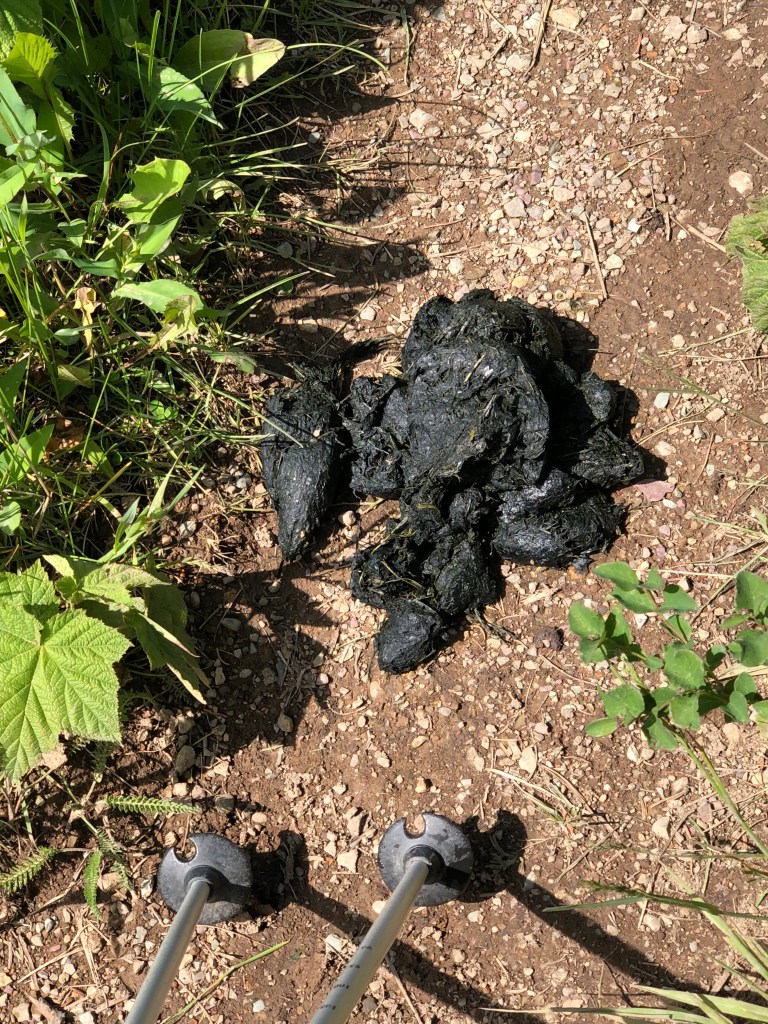
We got out of camp after everyone else—about 10:00 a.m. Morning clear, cool, windy. Pretty walk along the lakes. Saw some huge piles of bear scat and some paw prints along the trail past Crosley Lake. We could see the ranger cabin from above. Suspension bridge over the Belly River. High pyramid-shaped peaks all around. One of them is named Pyramid Peak—which one? High valleys on mountainsides in the distance. Super wildflower meadows. 7 miles to Mokowanis Junction Camp. Along the far shore of Crosley Lake, a moving white creature, hard to tell what, hard to get the perspective right, to even tell if it was large or small. Eventually it resolved into a large white water bird of some sort, when it left the shore and went to the middle of the lake. Vision plays tricks. Some other hikers reported a moose but we didn’t see it. Not as many hikers as I would have expected—early in the season I guess, and restricted camping. But tonight’s site is not full, just us and one other pair, a young couple from New Zealand just starting a thru-hike of the CDT. They picked the right direction. All the NOBOs are snowed in, in southern CO. We had a late snack/early lunch at noon near the junction with the Stony Indian Pass Trail (SIPT in the guidebook). Then along the flowered and forested slope above Glenns Lake. So even though we were near the lake the whole way we didn’t see much of it.
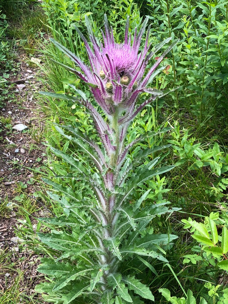
After we got to camp around 3:00, we had a snack, hung our bags, set up camp, done around 4:00 with several hours of daylight left. Put umbrellas and water and bear spray in the blue knapsack and took a 3+ mile day hike up to Mokowanis Lake and above. Impressive waterfalls at the river crossing at the beginning and also above Mokowanis Lake at the upper end. When the trail devolved to a social trail in dense riparian vegetation we turned around. Many many berry plants, mostly just beginning to bloom. Salmonberries (or thimbleberries? The maple-leaf-shaped leaves), huckleberries, strawberries. Good eating for bears later in the summer. Lots of blind corners so we clapped to warn any animals. One deer up there. Three campers. Lots and lots of geology and flowers. We returned just about 6:00. Pulled down the bags, made supper—chili and fritos. I remembered to soak ahead of time so not too chewy. R went for water. We have to be careful w/ the treated water to make the tablets last. Rained on and off during and after supper. Tons of mosquitoes. But the Insect Shield on the clothing seems to be working well. They flew around in clouds but didn’t bite. Tomorrow is our first big day—Stony Indian Pass 4 miles and 2,000 feet up. Then 9.7 more miles to Waterton Lake.
7/2/19 Tuesday. Last entry was at MOJ. So this will take a bunch of remembering. That morning (6/29/19 Saturday) at MOJ the NZ CDT hikers were not after all gone before we were up. They came through the food area while we were fixing breakfast. Morning cool but not wet. She was already in shorts. They just got their food bags down, packed them, and went. Presumably having their first meal of the day farther along. We managed to get ourselves out by 8:30 or so. This was our egg breakfast morning. Soaked overnight. Good stuff—will have to do more in the future.
Our morning’s route took us through the forest and high berry bushes above the Mokawanis River, gradually climbing until the cirque below Atsina Lake. Fantastic falls all down the side, Mokawanis Cascade. Several sections. The red and green horizontal rock layers make the water spread out and cascade down in splashy stair steps. Then at the head of the cirque, high above, a steeper cliff made a wide curtain of water, and another narrower falls stream nearby. Our path took us way up the side of the valley in switchbacks to the lake. We thought to stop for a snack by the lake but with all the high vegetation and the slope there wasn’t a good opportunity so we kept going. The Mokawanis River crossing was the wet one NZ guy told us about. I went barefoot since my shoes are slow to dry. It looked like there might be a rock hop to the right of the path, but at the far side it dead-ended into a thick willow overhanging the deepest channel. No going there. I angled upstream with poles for balance. Sooo coooold! Feet burning and then numb. Water to my knees but not so fast as to unbalance my steps. Finally ashore! R has much more sensitive feet (he doesn’t go barefoot) and quick-dry shoes so he waded across shod. Repackaged, we started the switchbacks up the side of the upper cirque, looking up at Atsina Falls, and around through vast slopes of yellow glacier lilies. The climb wasn’t too steep, past a little lake (no name on the map) through patchy short alpine forest, until shortly before the final steep climb we started crossing some stretches of snow. It was soft but not slushy, with lots of tracks to follow, so not hard or worrisome. Slow and steady climbing wound through the snowy woods to the top! Another couple up there was having lunch at the overlook. They were trying to scope out the way down the far side, since the top overlooks a sheer cliff higher than the treetops below. We speculated with them a bit, and she went on a reconnaissance and apparently found the trail, because they soon took off in that direction.
We retreated behind some trees out of the wind and sat down to lunch. (On the way up we passed 3 women, only one with a pack on, coming down. Asked them about snow, they said nothing of any concern. Later at the top we mentioned to the other couple but they said those 3 were day hikers who did not come up the pass from the north side but just turned around there.) While we sat with our lunch who should appear but S, with his friend P who joined him at Chief Mtn. They were to have camped at COS or GLH so although they were just catching up to us they came from farther down. We visited some and they headed on, the same way as the others. I went over to the lookout and saw them make the turn, in snow, which showed me where the path ahead would take us.
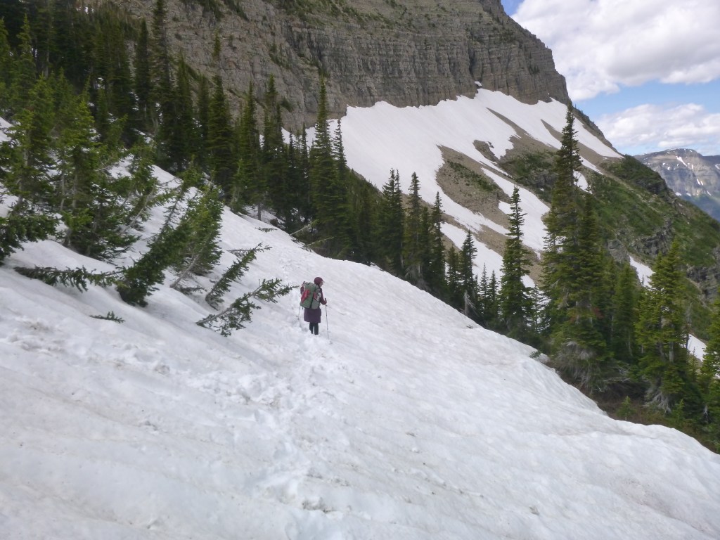
The clear dry path visible from the top outcrop was deceptive—the trail was snow-covered pretty much everywhere else on that steep, but fortunately largely forested, slope. We commenced picking our way nervously across, in our predecessors’ footsteps. About halfway across the first stretch of snow I slipped and fell, about 6 feet down and fetched up in a tree well. This spooked both of us. It looked like some people had been glissading down between the patches of trees, but without previous practice I could see us tumbling into a tree or log a the slope’s bottom and breaking a wrist or ankle. So instead I righted myself and got out the micro spikes, and we installed those around our shoes. Much better! On the next snowfield R slipped and got stuck with his pack and poles tangled up in the snow. I was at the end of that patch so I took my pack off and stowed it where it could not roll down—I am pretty sensitive about that after our misadventure of last year—and made my way back to R and brought his pack to the end so all he would have to deal with was snow. He said his pack was unbalancing him. I was getting the hang of sliding each foot forward to a stable resting place with each step, and the spikes were helping. We minced our way on down the switchbacks that way, all the way to Stony Indian Lake. R was slower so I waited at each clear bend. Finally near the water it was dry enough that we took our spikes off. The path wound around a cliff right at the water’s edge, as though the lake was overtaking the trail, with a short stretch just hopping on rocks to terra firma again. One more snow patch overhanging the lake shore, which we crossed with just our shoe tread, and we were on dry trail again. It took two hours from the top of the pass to the Stony Indian Lake camp at the foot of the lake. But we made it through! 3:00 p.m. and 9 miles to go to reach Waterton Lake Camp.
The first couple of miles took us down the open mountainside along Pass Creek, with falls and rock formations and glistening cascading water, eventually back into the forest and the junction with Waterton Valley Trail. I remember thinking it would be a bear of a climb going up that way. The long walk down the Waterton Valley was relatively level or slowly descending, mostly in forest, with long stretches through tunnels of head-high dense vegetation. Salmonberries were thickest, with huckleberries, roses, some strawberries in clearer areas. Many willows, but mostly more salmonberries. We couldn’t see our feet or use our poles. Of course none of the berry plants had fruit yet—they were all at the blossoming stage or just barely forming flower buds. Considering how recently this area would have been covered with wind and snow, this was an impressive burst of vegetation! Future bear food. Later in the summer hikers will have to be super careful in these areas. We got into a routine of calling out “No Bears!” at all blind corners and tapping our poles together.
We passed some wetlands on the left and then eventually Kootenai Lakes just peeking from the distance through the trees. There was a junction sign at the Porcupine Lookout Trail. At some point I decided we would need to pick up the pace, and made more of an effort. Since I am generally slower I usually go in front. So I tried harder. After a long late afternoon and early evening hike we hit the Goat Haunt sign and all the cabins from the now-closed Goat Haunt Customs Station. Just a tangle of trails and driveways and a big sign saying not to proceed if one was coming from Canada. We stood confused, when a slender young man with long curly blond locks approached and pointed us the right way to WAT camp. Maybe an off duty ranger. He said it was close, by the ford, and farther by the bridge. We walked around by the bridge, an extra half mile or so, on a long day. Still the camp was difficult to find. Finally a sign pointing us over a rock curb to the right, and a long winding trail through woods and mud, way past where it seemed the camp should be, took us to a right turn into camp, past the latrine to the food area near the river right by the ford. But the river was pretty wide and we didn’t relish another dose of cold wet feet.
Lots of folks at the Food Prep, including S and P and another PNT couple heading for Seattle, and a different guided group (same guide company—Glacier Guides) who all had to go back to the ranger station and get on the phone and straighten it out that they hadn’t checked in properly at US Customs in Waterton Township before hiking the lake shore and entering the US at Goat Haunt. The rest of us hung out and made supper. I think the was the Tuscan stew and polenta night. The Tuscan stew was a little chewy still although it soaked from mid-afternoon. There were so many bags and lines hanging that I had trouble throwing the rock and cord over without getting it tangled in the other bags. Finally had to cut a piece of our cord off to get it untangled and try again. Fortunately there was some extra length in our cord. We finally made it to bed about 10:00, not quite dark but definitely too tired to write.
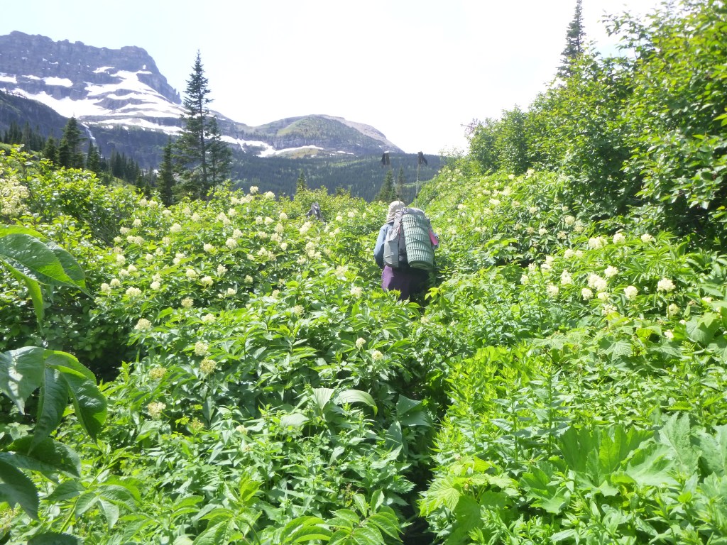
7/2/19 for 6/30/19 Sunday. The next trail morning was 6/30 Sunday. We woke up by around 7:30 I think. Packed up everything before going down to the food area. The guided group was breakfasting, their customs troubles resolved. From conversation it sounded like at least 2 or 3 women were young lawyers working for some big East Coast firms. S & P turned up, and the couple from SIP. The young woman (I’ll call Blisters to remember) was taping her feet. The guide helped, and I gave her a safety pin to drain the fluid. They were heading just to Lake Janet. We had our smoothie breakfast. Not as sweet as I would have made it if I’d tasted the mix at home. R said he liked it. So, OK. Somehow we didn’t manage to get packed up and going until almost 9:30 a.m. S & P arrived for breakfast just as we were leaving. Someone from the guided group saw a big moose near the latrine this morning, but it was gone before either of us went down there. Our way started out across the forested plain of the lake. At the camp exit was another trail heading off at a right angle that I wondered if it was a shortcut. We decided safer to go out the way we came in, to the junction with the rock edge to step over. Just as well. After we turned onto the main trail we came to a signed junction with the Waterton Lake Trail (along the western shore) and it indicated the campground in that direction. So our apparent “shortcut” would have spilled us out onto the Lake Trail not the Valley Trail. We turned west onto the Boulder Pass Trail and eventually started up the mountainside, still in continuous solid berry bushes and related tall vegetation. “No Bears!” was our mantra though this. Sometimes more open forest. Many birds. A few butterflies. Bear scat. Giant fallen trees. Soon we could see high up across the Valley on our left, what the map shows as Citadel Peaks, with high spindly spires against the sky. Sometimes big clouds, sometimes sun. Still cool—I kept my leggings on. S & P passed us in a hour or so, loping along twice as fast. Then we passed them stopped for a break near Lake Janet, and they passed us again of course, and disappeared into the brush ahead.
The trail filed close to the LJ shore, but the camp was farther upstream above the head of the lake. High Porcupine Ridge towering on the other side. At this point we felt like we were moving pretty well even with all the brush. The creek is called Olson Creek and the trail mostly stayed upslope from it. Some tributaries and some big open hillsides of beargrass and other flowers, look like avalanche chutes. Big waterfalls coming down from Porcupine Ridge. Still more forest, gradually climbing, to Lake Frances which we could just see through the trees. We were trying not to replenish water until really necessary, balancing that with giving time for the tablets to work. The guidebook recommends FRA camp for a lunch spot, so we decided to try it. The contour lines on the map aren’t very clear but it’s a steep trail down—the .2 mile is just to Food Prep; it’s just as far again straight down to the beach! Looked great but way more work than we wanted to commit to, to climb back up with packs on. We ate lunch at Food Prep, not even a view of the lake from there, and got water from a small stream and slogged back up the hill. Huge tall waterfalls on the mountainside across the lake, map shows draining Dixon Glacier. Soon we passed Hawks Bill Camp, named for the mountain ridge cliff across the valley. Then on up the creek valley, more tall vegetation, some forest, some open avalanche chute. The small lakes (no names) where the snow hazard mark is on the map, had no snow anywhere. But a vast willow floodplain across the lake, draining high, spectacular waterfalls—Thunderbird Falls, with Thunderbird Glacier out of sight above on the mountain.
Right after the little lake our climb to Brown Pass began in earnest. Up switchbacks through forest. R was feeling queasy so we put him in front to set the pace. I had made two peanut butter and raisin and apricot rollup wraps apiece and we dutifully ate them and that was too much food and gave him a stomach ache. My insides were waking up too. So we were a little preoccupied as we made our way up this spectacular pass surrounded by crags and peaks and snow and glaciers and waterfalls and bright colored rock and glacier lilies and beargrass and lupines and squirrels and marmots. (Other animals seen over the last few days—deer, and those little shrews near Goat Haunt, and toads in Waterton Valley, and so many robins and many other small birds, ducks on the lakes.) At the top of Brown Pass we met Songbird and The Dentist. White HMG packs. They were just down from a side hike partway up Boulder Pass! A lot more energy than we have for sure. They said they didn’t see any bears but they heard another party got bluff-charged by a bear up there. They didn’t go far enough to get into dangerous snow but there’s still supposedly some up there.
We didn’t linger although the views were awesome, because we were in a hurry to get to the latrine at BRO Camp. BRO wasn’t open to campers yet but its latrine is fully open air and looks out over the whole wide valley and the mountainside up towards Boulder Pass. We spent almost an hour there but it was so needed. The other folks passed us. We resumed our long descent. Bowman Lake Trail drops steeply down the escarpment from Brown Pass, winding around the hillside past waterfalls cascading through the thick forest and bursting out just above the trail and vanishing over rocks into the undergrowth below. Rock formations. Trail would switch back and cross the same stream and another cascade lower down. The Valley of the Waterfalls. Then more steep downhill. So far so good but the steepness slowed us. We had some anxiety about the time, with so many miles to go. Finally the slope eased as we joined the Bowman Creek valley. Bowman Creek is big, more like a wide river. Somewhere along the way we came to a crossing of Bowman Creek that had flooded, with a wide gravel channel all washed out, and huge trees all piled high where the crossing used to be. We looked for where the trail might go, and found beaten earth and, as R pointed out, trekking pole marks, leading onto a giant tree spanning the water. But the tree at the other end was lodged high above the tangle of broken logs on the other bank. Past that was a constructed small log bridge across a second channel. It took some examination to see where there was a way down from the tree trunk to the log jumble to the path to the bridge. When we could see the way we walked across. As I squatted at the end of the tree to lower myself to the logs, I became aware that my left knee, which had become gradually sore during the steep hike down from the pass, was really stiff and starting to actually hurt. I remarked on it to R but we had to carry on so we did. At another smaller tributary crossing too deep to rock hop, I walked a dicey log across but R chose to wade since his shoes were already wet. After that it was just miles and miles of head high vegetation, “No Bears!,” bear scat, muddy footprints of faster hikers, towering mountains above. Back when we were just partway down Brown Pass but still up high, we could see all the way down the long valley to Bowman Lake. 3.8 miles to go, already 6 p.m. We walked in a daze, so tired by this time, getting harder to appreciate the surroundings. At last, around 8:45, a sign with Campground thataway, and we walked past a couple of tent sites, the latrine, and then the Food Prep. A guided group of Asian tourists had a fire going at one square, and everyone else sat visiting after supper at the other square. Still light of course. Hard to believe we were really there at last. Bulgur wheat pilaf for supper was so good. Many bags on the hang bar, hard to find a spot. R at latrine. One of the Asian women, super friendly, helped me hoist ours up. We had a nice visit with the other folks during supper. Turned in about dark, ~ 10:30. Knee sore.
7/2/19 for July 1 Monday. We woke up just before 7:00 a.m. Others already up. Knee more sore. Broke camp and went for breakfast, the last of the granola. Either the previous evening or that morning we learned P just graduated from University of Chicago with a PhD in Anthropology of Toxicity (have to look that up when I can get online). The Coeur d’Alene folks, the social work doctoral student trail-named Songbird and her husband who is a dentist. Some other guy who is a pharmacist working at a hospital. Big discussion about how hard it is to get academic jobs now or really any decent job in one’s field. About the grad students at University of Chicago striking for fair wages and benefits. About C d’A folks backpacking and pack rafting in Alaska where he is from. So many interesting folks. At breakfast C d’A folks offered to take Sean & P to Kalispell to the REI to get P a new pack b/c his is ancient and broken. Problem is he is tall and needs XL. They all took off right after we did, but since we went briefly the wrong way on the trail we didn’t see them again. I was thinking we must have passed a sign with the Campground name and was looking for that, but after a few minutes a double check of the GPS map showed the truth and we turned around and went in the direction of the hitch rail (the horse route) which also led to the real sign, the bridge, and the real trail down the lake.
A long day ahead—15 miles, 7 on trail and 8 on road. Mostly level path along the lake, gentler ridges now, across the lake and above. Saw some ducks. Eventually began to encounter day hikers from Bowman CG. Fishing people. Kayaks on the lake. Snack lunch overlooking the lake. Left knee getting more sore. Low on water, we filled from a small side stream without treating. Tasted wonderful. At last, people on a beach across the water, and the Ranger station, the campground, a nice ranger in an education tent. We filled our water again at the spigot and started down the road about 1:00 p.m. The road still had nice pretty forest on either side but when the sun came out from behind the clouds it was hot and dusty with cars and trucks going by. And my knee getting stiffer. Not exactly too painful to walk or anything, but worrisome. So when after about 2 miles of the 8 mile road walk a guy in a pickup bulled over and offered us a ride we really didn’t care about being purist and took him up on it in an instant. Name of Luke. Lives in Whitefish. Just hiked up Boulder Pass, lots of snow but passable (for him). He stopped at the Ranger Station on the way into Polebridge to report on the snow situation. Said Oliver the Hostel owner is really nice and works part time at the Ranger Station too. He dropped us at the Mercantile. We got sandwiches there and ate them (or partly—they were huge) at the picnic tables outside. A cyclist from France came over to visit and ask questions about the area. He and his wife have been cycling 8 months. From France, boat to Belize, then north and eventually on the Divide Bike Route, going on into Canada next. Big touring bikes. Amazing what some folks can do. Rained, we got our umbrellas out. Then off to find the North Fork Hostel, about 1/4 mile away down a side street. All the streets are gravel. We followed the signs. No one there at first but sign on front door said PNT hikers and Divide bikers come on in so we did. Big wooden rustic building, quiet, old cool stuff everywhere. We waited in the Common Room until Oliver appeared and showed us the tiny Couples Room I reserved, and also showed us around. No wifi after all, no cell service, no laundry. But beautiful comfortable furnishings, well-equipped kitchen, wide wooden porches, upstairs dorm, very friendly. Off-grid so lights—solar and propane—dim. Headlamps needed inside. I lay down to rest about 3:00 p.m. and didn’t awake until nearly 6:00. Hard to go up and down stairs with gimpy knee. Made sausage and cheese quesadillas for supper. Then headed for bed again. We called J from the dial phone landline.
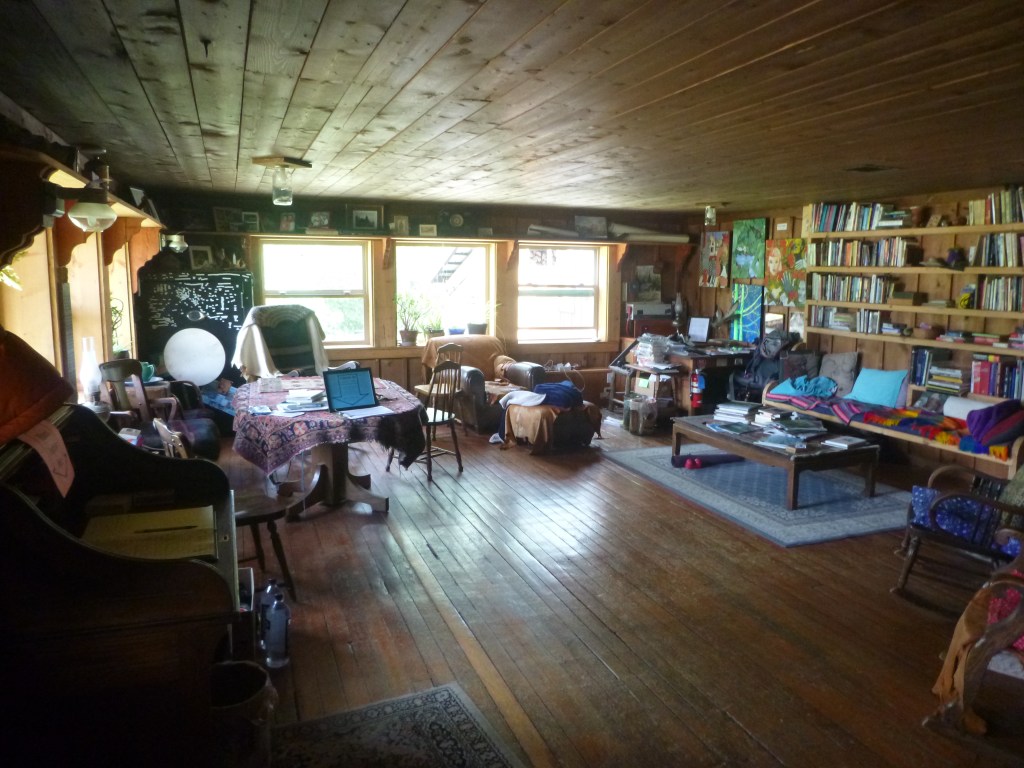
7/2/19 Tuesday. We told Oliver we would like to stay another night to rest my knee. He moved us downstairs to make it easier. [Also the “Couples Room” is windowless and stuffy and claustrophobic, so avoid it if you go to Polebridge.] Today was spent reading, writing this out on the porch and in the Common Room, shower, laundry in galvanized tub out back by hand and the clothesline. Everything dried before evening rain except the socks. Some other hikers came in today including Kansas folks from SIP/Blisters, and a couple of PNT guys who recognized me from the Facebook group. Lots of vacationers up to visit the Park. I ate the rest of my Mercantile sandwich for breakfast, we had leftover snacks for lunch, and R borrowed a bike to go get burgers and huckleberry bear paws for supper. I can walk around but stepping up with the left hurts so I lead down with the left and up with the right. Some swelling. R found compression wrap stuff (not ACE, but that loopy stuff) at Mercantile and I’ll try it tomorrow. The local Park rangers and friends grilled sausages in the deck and their chatter was interesting, about what people wanted for permits and how unprepared some of them were. I asked Oliver about the palmate-leaved berries. He says thimbleberries, not salmonberries. I figured one or the other. I sorted our resupply box and loaded our Ursacks for tomorrow. Hope we can go on to Eureka. R hiked last year with a bloody toe. Maybe I can make it through. Tired now. Already used more than 1/2 this notebook. Need to be more concise.
7/21/19. Well no need to be concise after all. Need to write more often. Sadly there is plenty of time and I am no longer tired in the evenings. At best we have had a few day hikes. Lots of geology, some industrial technology, a little wildlife, some history. But our backpacking trip has ended for the season. And I guess I’ve been too sad about that to revisit and write up the last 3 days of the trip. Resolved to do it now, hoping not too late. Much detail will already have been lost.
On the morning of Wednesday July 3 we woke to find our socks finally dry(ish) from being on the windowsill overnight. The bunk room window looked out into the long lean-to greenhouse so the open window wasn’t affected by the rain. The morning it was still raining. We thought, well, that’s why we brought rain suits, and we can hike in the rain. We showered and got organized. The family dad was teaching the little girl, nearly 3, to sing Frere Jacques. Cute. I wrapped my knee thoroughly with the wide red compression wrap. Don’t remember what I had for breakfast. Granola maybe? R got up a little later. So dark in the hostel with cloudy rain outside. Both the electric lights and the propane lights are dim. Headlamps needed. I used up a pair of lithium batteries in 2 days. After we were all sorted and packaged—R was looking for missing items until the last minute—we set out around 10:30 a.m. in a steady sprinkle, not too bad. The wrap helped my knee feel better. We took some last photos of Polebridge.
The gravel road took us southward out of town and across a bridge to Hay Creek Rd., also graded gravel. A FS road. Up a hill, with Hay Creek on our right. Several expanses of recently logged hillsides. Looks like they are leaving some trees standing as seed trees. Only one vehicle passed us—a man in a big pickup, heading up the road same as us. After another mile or so we topped a rise and saw, way ahead, a big log cutting machine, right in the middle of the road, with the truck parked next to it. As we neared, it became clear that the machine was trimming logs to a certain length and stripping the branches and bark, and stacking them, all in one operation. The pickup driver was running the machine. Some signs on the approach, lumber company land, I don’t remember the name but could maybe look it up. Apparently they must have exclusive rights to the road because the machine/truck/log piles were blocking it completely. We detoured up the hillside a bit to go around. We were making good time on the gravel road. Lunched at the bridge over the creek. Not sure of the mileage since I stowed the maps in Spokane. After some miles the route split off onto a former jeep road now closed and blocked with giant chest-high berms across it at intervals to prevent vehicle access.
Then we were back in the unlogged forest. Steady climbing. We brought a couple of platys of water from the lunch crossing. Probably too heavy but we weren’t sure of water access. The wrapping helped my knee a lot. The trail mostly climbed but not too steeply. That day we ended up hiking all the way to that lake campground, 18 miles counting the .6 mile campground entrance road spur. I don’t remember a whole lot about the plants and animals but it was forest, and mainly on a slope, with Hay Creek far below on our left; we could hear it but not see it or access it. The lake camp was full-up with holiday weekend vacationers. A couple of bikepacking parties on a grassy clearing. Others were big cabin tents and trailers and trucks. We found a little lumpy tent site up a rise from the bikers, between some trees, with the main lake camp down the hill on that side and a wide marshy lagoon below on the other side. During the evening we heard loons out there. As we were making camp the wind picked up and the temperature dropped fast and we were all bundled up from the cold. Some July weather! Fortunately the rain had stopped earlier in the day. I was going to cook at a little fire ring but the wind was so strong I retreated to the shelter of the tent vestibule even though we were still in bear country. Late supper, asleep by (or before?) dark. Ursacks hung in a small spruce across the path. At least no more requirement to hang them on high bars.
7/21/19 for 7/4/19 Thursday. The next morning, still cold, less wind. Rain again, for a bit. On the way to and from the toilet we visited with the bikepackers. Russian and German. On the Divide Route. Going to Whitefish 30 miles south, for July 4th celebration. I felt for the vacationers camped out there for a summer holiday and it felt like winter. We were feeling pretty confident as we walked back up the access road to our trail. Once on the Forest Road, we needed to find that water source, the culvert channeling a tributary under the road. The Guthook graphic misplaced it. I didn’t think to scroll down to comments. So when I was sure we had gone way beyond the marked spot I became concerned and left my pack with R and walked back about 1/4 mile to the marked spot. Yes, creek way below, no apparent access down to it though. Puzzling. Digest suggests culvert water is farther up. So I climbed back up the road to R and we continued, keeping a sharp eye out. Finally! Culvert as described. Scrolling down I found the hiker note that water would be ahead and not at the mark. Lesson learned. Still 14 miles to Blue Creek which showed as the next water so we loaded up with enough for the whole day plus some extra. Just as well since we didn’t make it the 14 miles from there. I had foregone the knee wrap on this day since the knee was a bit better and the thick wrap had been chafing the inside of the other knee with each stride.
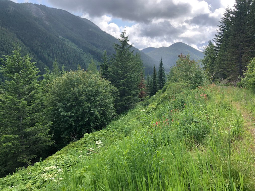
We climbed that morning on up onto the Whitefish Divide, which is supposed to be such long and beautiful views, but we saw little but what was nearby because the clouds closed in and the rain resumed on and off all day. At least we were on trail again, that TR 26 trail. I remember it was slow going what with the wet and cold and the climb. Stopped to install and doff rain gear or umbrellas as needed. Showed R how to use trekking pole straps to take the pressure off hands and gripping. We went over that last year but over time he forgot. Plus he leans on his poles a lot harder, when using them for balance over rocky areas and across creeks. Gripping was making his hands hurt from carpel tunnel syndrome. The straps helped. It was a fulfilling and interesting day, but very difficult. Lots of up and over and saddles. A couple of junctions to figure out. Misty mountains, long valleys, deep purple and gray clouds. Not freezing but not warm either. Our socks and shoes had been soaked all day and since sometime the day before. Wrung out the socks but body heat dried nothing. Of course my shoes were “waterproof” so less able to dry. Wet vegetation and recurring rain. I wore the dance pants over my leggings, for warmth. Later in the day it became clear we would not make it over Mt. Locke to Blue Creek. We agreed to start looking for a camp at 7:30 p.m. Actually we stopped a little sooner. Because were were traversing steep mountainsides, and the map showed mostly the same on ahead, it was clear that the only opportunity for a flat spot would be the saddle just before the climb up Mt. Locke. We decided to camp there. The burn area was just beginning, at that saddle, so we backtracked a little but, to the start of the saddle, to avoid dangerous dead trees. Still it was hard to find any spot clear enough and flat enough for our little tent. Finally R found a tiny spot on a thick patch of blueberry plants near the trail. (I had been trying to find something farther from the trail but with worse results.) We had seen no one all day. The trail junction signs had been old and worn out. The side trails overgrown. Didn’t look like much of anyone, except PNT hikers, was using this area. We were all alone on this high mountain saddle with burnt forest on one side and this little spot where we would just fit to eat and lie down and sleep. I think about this aspect of backpacking often—how we have been enabled to get ourselves so far out beyond our apparent capabilities, but I also feel especially drawn to these times.
7/22/19 for 7/4/19 Later that evening after dark (i.e. well after 10:00 p.m.) I started to hear faint booming sounds, like boom-boom-buh-boom, that went on for about 15 minutes and then stopped abruptly. What could that be? Checked the time—ended exactly at 11:00 p.m. I realized Oh! 4th of July fireworks. All the way out here in the mountains and wilderness? Well we were nearly 40 trail miles from Polebridge and their big celebration, but maybe only 20 as the crow flies miles. That would be the closest possible source of the sound.
7/22/19 for 7/5/19 Friday. On the morning of July 5 we got up and breakfasted and packed up as usual. Wet socks and shoes—rain during the early morning so all vegetation wet. The first wet night, before Polebridge, up in Glacier, when everything including especially socks and “waterproof” boots, from wet vegetation closing in on the trail (Oliver at North Forks Hostel/part time ranger called this type of trail “the car wash”), I tried the technique of wringing my socks out as thoroughly as I could and spreading them out under the foot of my sleeping bag hoping to dry them by body heat. All I got for that effort was wet socks and a damp sleeping bag (at the foot) in the morning. So I gave up on drying socks in camp and relied on wearing nice dry sleeping socks all night. Still on the morning of July 5 the two blisters on my right 4th toe, where it slides under the 3rd toe, had re-formed. Bandaids fall off in the wet. Tincture of Benzoin, they still fall off. Moleskin and duck tape fall off in the wet. I just kept re-taping. I wondered how Blisters, from back in Glacier, was doing. They got to North Fork Hostel the day after we did, and were staying for July 4th and talking about going to Kalispell for new shoes.
7/27/19 Quiet hot afternoon in the shade at Smith Rock State Park. Back to the PNT. That morning 7/5 after pasting ourselves and our toes together we embarked onto the trail as usual. And within 10 minutes ran into trouble. We were entering forest seriously burnt in 2017, just 2 years ago. So many trees had fallen that soon after we started uphill the trail was completely obliterated. Various use routes led us around one nest of deadfall and through another, branching and converging, backtracking sometimes when we met a dead end of tangled broken trees. We knew from the map to work our way around to the right as we climbed the slope. But the trail seemed gone. The map and compass and GPS and other people’s traces were it. The GPS was only approximate. Sometimes the slope got especially steep but we were trying not to get ourselves too far around the hillside. We didn’t want to lose our chance of regaining the trail should it reappear. So “aiming off” a bit to the left, which was steeper. R especially stressed because of balance. Very slow going. I don’t remember how long it took but we were maybe 2/3 of the way up to the lip of the mountain when we finally met the trail again, wrapping the contour on a long switchback. At first, hard to tell which way to go. GPS mark looked like it would go up to the left, so we tried that way for about 100 yards, but that then appeared to be wrong so we reversed. Higher on the slope the burned forest thinned so less deadfall. Then some steep meadows with grasses and flowers. And the clouds were finally lifting. The trail leveled somewhat across the top, with scattered trees, sun vegetation, and views across mountain range after mountain range, in all directions. Woohoo! We noticed a cairn on our right and din’t think much of it, and shortly found ourselves at the very top. With not a falling-down cabin but instead a burnt foundation and a few broken and burnt metal artifacts, nothing more.
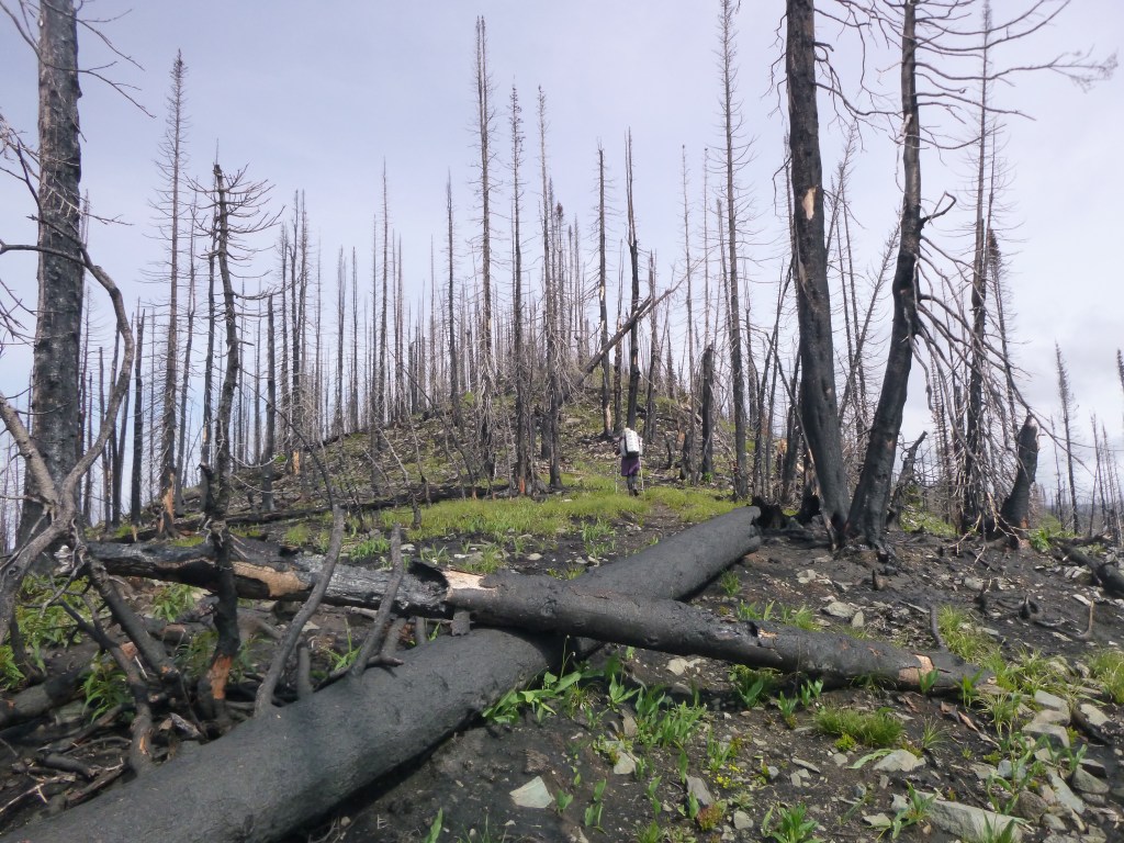
We stayed a while, taking pictures, enjoying the views of the country around, and exploring the top. The sky was still not clear and it was very windy. But where did the trail continue? Cabin supposedly at the end of a short spur trail. We walked the whole circle around, finding only the trail we arrived on. Other directions were steep cliffs and vertical slopes. We backtracked to the cairn. Aha! Two cairns and a teeny trail between them and around a rock outcrop and then onwards. Be more observant! We, and the trail, picked our way across the steep, steep mountainside, with the peak on our left and forest unending below to our right. Then we dropped to a ridge on the north side, enjoying views all the way along, and lots of flowers. The burn area covered the mountains across the valley to the east. At some point, I’ll need to check the map where, we re-entered unburned forest and the junction where TR 26 left us and we joined the Blue Creek Trail. Down, down. Oh yeah, and all this morning from after breakfast at our camp in the saddle, through the burnt forest and the bushwhack and up and over the mountain and down again, was with NO water at all. So we were getting thirsty for sure. At least there was regular trail going down, and healthy forest not burned. Except for all the fallen trees across the trail. The Digest says the area had been cleared but apparently there have been lots of newly fallen trees since. So once again we slowed to a crawl—or a climbover, or a bushwhack around—to progress.
On the downhill my knee and my toe were all acting up again. R’s hands hurting from leaning on poles. It was a long way down that mountain. At last we heard a bit of water—a tributary coming down from our left—and refilled and drank and drank. The forest was deep and lush and wet. Yes! Lunch was late, about 2:00 I think. Not much of a place to sit on the slope so we ended up parking ourselves on a narrow wooden bridge crossing Blue Creek and dangling our tired feet over the side. Not much chance of other hikers needing to cross. We rested and enjoyed the forest and the water. I re-taped my toe, re-installed damp socks and shoes, and re-wrapped my knee, this time on the outside of the leggings which I kept on since it was still chilly and damp and windy, and also I wanted to protect the skin on the other side from the chafing.
The trail down the creek widened some but there were still occasional fallen trees. Where it crossed the creek again, the water was higher and there were some logs and rocks but no bridge. I stepped tentatively onto the first log, testing it, and at once it shifted under my foot. As I shifted my weight back suddenly to the bank again, R tried to catch me and fell into the water, and I was standing in water up to my knees. So much for feet starting to dry out! We waded across and squished our way on down the trail. That crossing was the 94.4 mile point with the (small) campsite that was supposed to be the 14-mile point we would have been shooting for, water-wise. The rest of the afternoon’s walk was just down the creek in forest, trail sometimes wide and sometimes overgrown, then apparently old road bed. I was trying to focus on the plants and bugs and not on my limping knee (the wrap helped) and angry toe.
Late in the afternoon we arrived at FR 114 and a big PNT sign. Campsite just before the road. We decided to camp there. Maybe could have gone farther but wanted to give ourselves the option of a night to decide what to do. So we collapsed at the edge of the woods near an old fire ring. At some point a couple of bikepackers came down the road and poked around the corner by the trail, signed the FS register, and we all visited for a bit. That evening R said his hands were hurting too much. I was looking at the trail ahead on the map. 3 miles north on FR 114 and then wrapping around the mountainsides, that lookout cabin, Mt. Wam, Hwy 93 road walk. Another 40 miles or so, 3 hiking days, to Eureka. And between the north end of the FR 114 road walk and Burma Rd., no other place to get off the trail. I was feeling daunted by knee and toe but thought I could make it through. R was super worried about permanent nerve damage (as per the hand surgeon) if CTS flare-up continued, plus it hurt the most at the most stressful times for him, like on rough slopes and across creeks. So he really wanted to leave the trail. So that’s what we decided. That night I sadly hung the Ursacks on little trees in the thick overgrown forest edge, almost dark. I don’t know how we would have done if we were dependent on 10-4 hang. Fortunately the little orange tags on the ursacks are reflective, for easier finding in the dark. I walked camp all barefoot to air my feet but that made for picking my way slowly.
The next morning 7/6 was a Saturday so we hoped for some recreational traffic on FR 114. At our crossing there was a horse chute and not much else so not an especially active trailhead. We packed up, no hurry. I was out of not-soaking-wet hiking socks so I put on my Injinji sleeping socks, nice and dry. No bandage on toe—no point, wouldn’t stay put. Wet shoes. We commenced walking south on FR 114. 10 miles to Hwy 93, could walk if necessary. Passed a hunting camp installation and a historical sign (look this up—on Grave Creek Rd.). Some vacationers with full cars went by. After a mile or so a young man in a big pickup stopped for us. His little daughter Marley in the back in her car seat. Friendly. Family up fishing at their cabin. Live in Whitefish, the other way from Eureka. When we got to Hwy 93 he decided to take us to Eureka. So nice! I had him drop us at Silverado Motel because it advertised laundry facilities. Silverado Motel and RV Park turned out to be a pretty desolate place. Clean and functional, with also a casino bar and a small golf course. But mostly empty, on a summer holiday weekend in a recreational tourist area. Maybe two RVs in the whole place, and no cars at the motel. The proprietor at the desk was cordial but uninterested. A younger relative was cleaning rooms. No option to go see the town, the highway walk being too far. Laundry was way far down the driveway past the golf course next to the RV loop. I walked back and forth to tend to it, in purple shirt and dance pants. We had a pretty view of the mountainside out across the valley, from our window. Went to fix supper outside on their patio overlooking the golf course, but it was so very windy that we ended up taking our food back inside to eat. Then it was just cleaning up, sorting gear, internetting, etc. until bedtime. I did notice on the way down FR 114 walking (before our ride picked us up) that the Injinji socks helped a lot with the toe that wants to slide under. So I’ll be switching to Injinjis for my main backpacking socks I think.
The next morning, July 7, we really wanted to get on back to Spokane. Zero public or commercial transportation out of Eureka so we packed everything compactly and
8/3/19 (resuming journal from memory) set out to hitchhike or walk through town. It turned out to be not very hard. A man that grew up in the area took us through Eureka and on down to another smaller place (need to look up on a map) where he lived as a kid, got married there, etc. He just wanted to show us. Then took us back out to the highway and convenience store where we would be able to see about another ride. Second ride was a couple who live in Kalispell, work in the medical field in Whitefish, and have a cabin near Eureka. They took us all the way to the Amtrak Station in Whitefish.
We asked at the counter about rental cars and buses. Hertz counter inside the train station, tended by an older man. Signs about it being the earliest Hertz counter in a train station or something. He said the bus not helpful—it’s a van run once a day by the tribal government that just goes to Missoula where Greyhound stops. But not on a useful schedule for catching a Greyhound to go farther. He was friendly, and let us keep our packs behind his counter and charge our phones. But he didn’t seem to think much of tribal operations, which attitude grated a bit. We bought Amtrak tickets at the other end of the station. The Spokane-bound train scheduled for 9:15 p.m. or so. Plenty of time to go walking the town.
We went for lunch. A place with outdoor tables. Excellent wrap for me and R had a burger or something. Art fair on the main park by the Amtrak station. We enjoyed exploring that and even go some winter holiday gifts. R visited with a weaver for a long time. Indian art. We walked over a long highway bridge over the main freight rail yards and along a paved hike & bike trail to Whitefish Lake beach. A family walking ahead of us showed us the way through the neighborhood. Popular local beach with kayaks and beach toys for rent. Bath house. Grassy slope. Busy. We found a spot and took a nap. Then walked back to town and got sandwich (me) and salad (R) at the little grocery. Took them to the park kiosk to eat under shelter because it was starting to sprinkle. Art fair was all cleared away by then. Met a family there also taking shelter waiting for the train. Two moms, a brother in early teens and a sister maybe 10 or so. Watching a show in their iPad. We had a nice long conversation about their holiday week and our hike and a bunch of other stuff. They live in Portland.
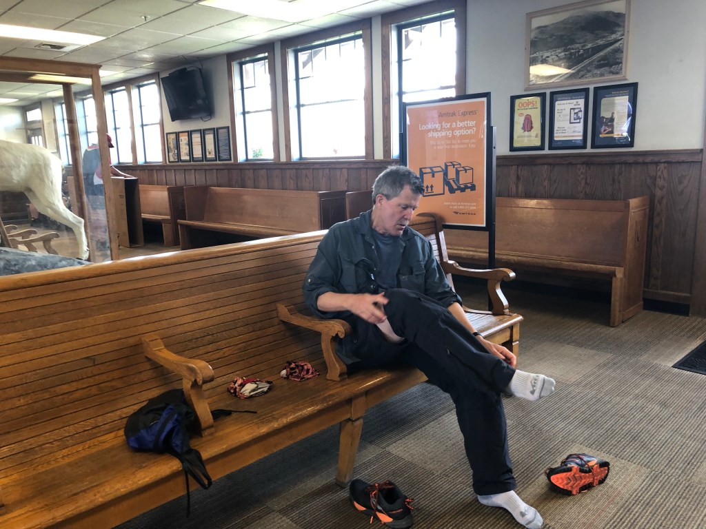
Later it was time to head back to catch the train. Still light—daylight until very late so far north. Lots and lots of people in the station for the train by then. We got our gear and checked email notifications. The train was running late. Then the train was running even later. R played the piano for minute. (Yes the waiting room had a piano.) Later a fat bubba-like guy played piano for quite a while and he was really, really good at it. The train finally arrived around 10:30, everyone tired. Chaotic boarding with so many people. We were assigned two different already-occupied places in two cars before the conductor finally seated us downstairs in the disabled area. We tried to sleep but it was even harder than on the trip out. I was wishing for a bunk. Spokane around 4:00 a.m. after passing the time zone change. Lyft driver. I opened the passenger door which immediately got hit by a pickup truck. There was this whole thing then with the women in the truck and a policeman. So groggy no sleep. Finally the Lyft driver took us to J’s. I spent the next week trying to straighten out the Cruze registration (no luck), planning an alternate road trip, and getting cabin fever. So that’s the end of our first PNT hike, about 95 miles. A disappointment in that we had to bail, but a good hike while it lasted. Resolved to be more fit by next summer. (Little did we know….)
Typed in early April 2021
